Before going to bed I had a tantalizing glimpse across Reine bay from our room, but it was really too dark for a decent view around the fjord and the mountains.

Monday evening: the first view from the front window of the Reine Rorbu in which we stayed
We woke up on the east side of the Lofoten Wall, Lofotveggen in Norwegian. That's the colloquial name for the Lofoten Island chain, which is really a granite mountain range jutting straight up out of the North Atlantic. The height of these mountains protects the eastern side of the islands from the harsh weather of the North Atlantic.

The Lofoten Wall - a Google Maps view of the area; The North Atlantic beyond to the west, Reine safely on the eastern side
At almost 68ºN, the Lofoten islands lie above the arctic circle. This was part of the attraction for us, but it places the archipelago well north of most parts of Alaska and even north of much of Siberia. Temps ought to be simply frigid, but Gulf Stream currents (and offshoots called North Atlantic Current and the Norwegian Current) circulate just the right way to keep this area miraculously sub-arctic. Weather geeks say it this way; when measured by latitude, The Lofoten Islands have the largest positive temperature anomaly in the world. Instead of Siberian temps, winter is usually just around freezing. So our September visit was delightful, just like late summer or fall temps back home in New England.
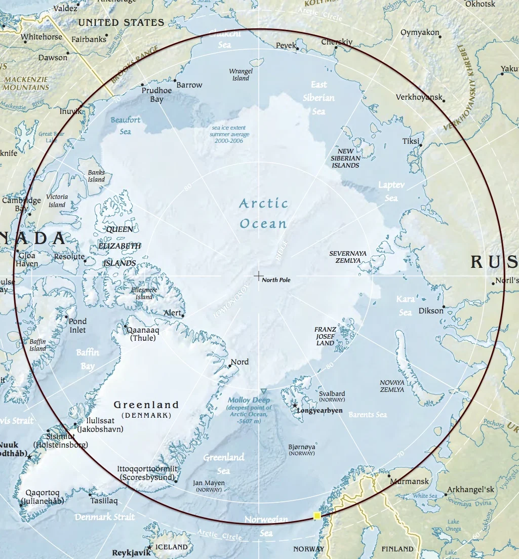
I dropped a circle at 67°55′N, marking Reine (yellow dot) latitude. It's easy to see how far north it lies compared to Greenland, Siberia or Alaska. Map from CIA World Factbook.
Tuesday morning I woke up early, despite having traveled and hiked around the countryside the previous day. Just in front of our cabin (Rorbu - more on this in another post), I was rewarded with the stunning daylight version of the vista across Reine Bay. I decided to go on a little walk-about with my camera, ...not that I ever leave home without it ;)
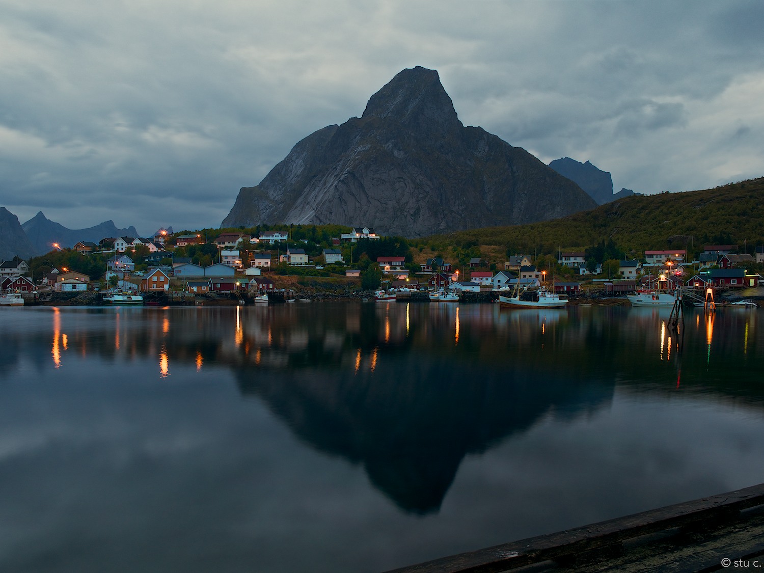
View upon waking Tuesday morning
Two fjords, Kjerkfjorden and Vorfjorden, provide waterways far into Lofoten, to inhabited villages at the far reach of the fjords. Though this is a working fishing port, Reine has become quite a tourist place, a downright destination. In November 2007, National Geographic Traveler Magazine rated the Lofoten islands of Northern Norway the third most appealing islands in the world. One of the jewels of this archipelago is the town of Reine. Some years ago, a Norwegian magazine apparently rated Reine as the most beautiful village in Norway. That said, the Lofoten Islands are just fantastically scenic; each town seems to outdo the next with respect to views, location and the boldness of the stunning backdrops.

Small as it is, It's very much a working port, with waterways continuing between the distant mountains via fjords Kjerkfjorden and Vorfjorden.
Everywhere I turned was a 'view' - even just looking across a working harbor was magnificent. The Lofotens are incredibly stunning - a photographer's dream; vistas at every turn & in every direction, interesting ever-changing light as clouds move over the mountain range alternatively obscuring & revealing the sun, each village a new discovery, driving & navigation made difficult with each head-snapping, oh-my-gosh-tourist moment, moving just a few hundred yards/meters in a different direction to be enticed with an entirely new photographic moment - this place should be on everyone's bucket list. At the top.
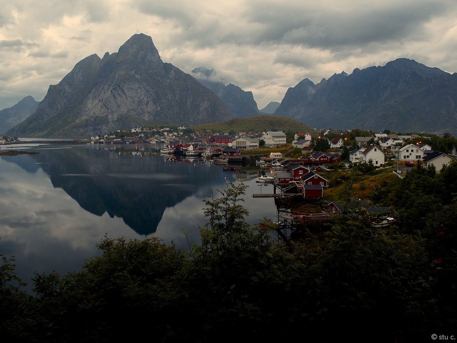
Early morning view back over the bay to the peninsula on which the town of Reine sits
I was so taken by the views, gawking so badly, that I only managed a fairly short (one mile?) walk around the peninsula on which Reine is situated. It's the village closest on the right, the peninsula is seen arcing from the lower right into the center of this photo. Though it may seem so from this vantage point, it doesn't actually connect with the hill on which the far buildings stand below the cliff.
And just like this, the entire Lofoten Archipelago is made up of a crazy patchwork of fjords, towering peaks, sheer cliffs, twisty bays & inlets and a narrow, ever curving road, somehow threaded from one tiny spit of land to the next.
Some links about Reine & The Lofotens, some of which was used as background info for this page
Wikipedia - Reine
Wikipedia - Lofoten
Switchback Travel on Reine
World Maps at the CIA
WikiTravel - Lofoten
Atlas Obscura - Temperature Anamolies
The fabulously detailed Norwegian Map at Norgeskart